Hi IPUMS team!
First of all, thank you so much for the support you provide for the research community. This forum has helped me a ton with my research.
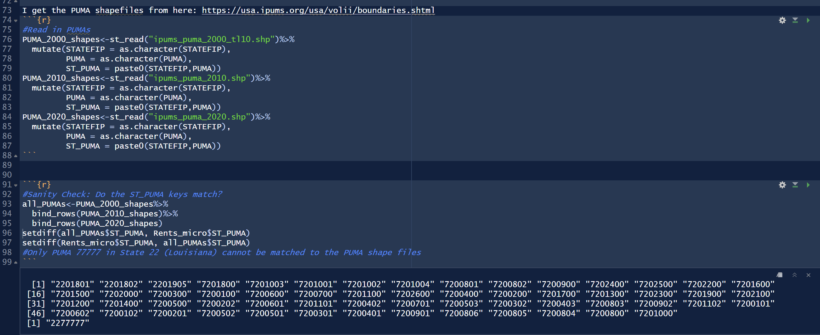
I am trying to so spatial analysis with the PUMA shapefiles that I downloaded from here. I use the 2000 PUMAs with 2010 TIGER boundaries, 2010 PUMA-2010 boundaries and 2020.
However, when I checked if I have all the PUMAs that I have in my microdata in my shape file collection, I realized that one PUMA is missing its shape file. It is just this one, 77777, in state 22. Can you tell me what’s going on here?
For your reference, my dataset is a data set spanning years from 2009 to 2020. Therefore, it should have all 00,10,20 PUMAs in the PUMA column. Therefore, in theory, the combined shapefile, ‘all_PUMAs’, should exhaust the unique PUMA identifier I made by pasting state and PUMA codes, which is called ‘ST_PUMA.’
Thanks again for ALL your help!